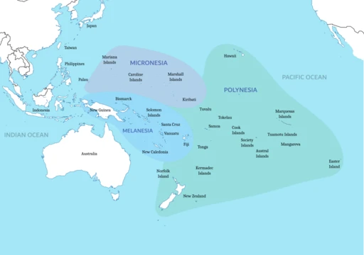
Amami Islands
Japanese archipelago in the Ryukyu Islands, southwest of Kyushu.

via Wikipedia: Amami Islands · see source
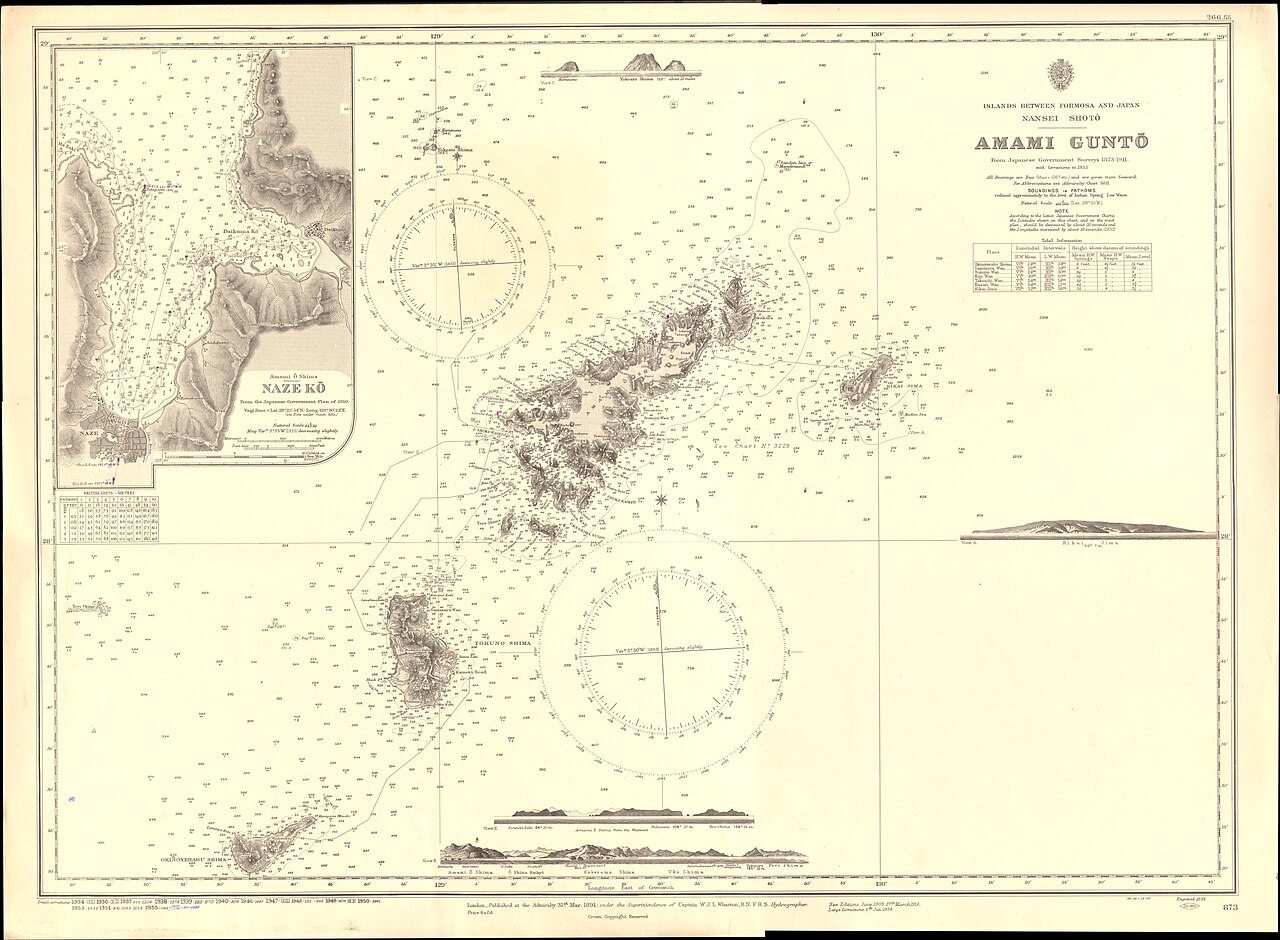
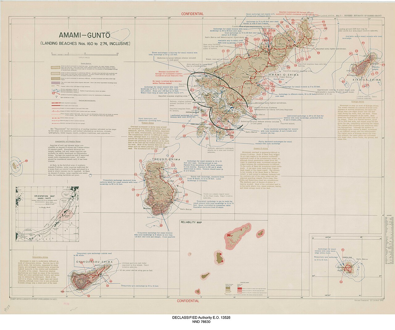
The Amami Islands are a Japanese archipelago in the Satsunan Islands, which is part of the Ryukyu Islands, and is southwest of Kyushu. Administratively, the group belongs to Kagoshima Prefecture, Japan. The Geospatial Information Authority of Japan and the Japan Coast Guard agreed on February 15, 2010, to use the name of Amami-guntō for the Amami Islands. The Amami Islands are limestone islands of coralline origin and have a total area of approximately 1,240.28 square kilometres. The highest elevation is Yuwandake with a height of 694 metres on Amami Ōshima. The islands have a humid subtropical climate with very warm summers and mild winters. Precipitation is high throughout the year, and the area is subject to frequent typhoons.
- total_area
- approximately 1,240.28 square kilometres (478.87 sq mi)
- highest_elevation
- Yuwandake at 694 metres (2,277 ft) on Amami Ōshima
- population_2020
- 104,281
- climate
- humid subtropical (Köppen Cfa)
- administrative_division
- Kagoshima Prefecture, Japan
- official_name_since
- February 15, 2010 (Amami-guntō)
Verified Timeline
Lore & Background
The Amami Islands were once home to local pirate groups. During the Heian period, a pirate force referred to as the Nanbanzoku raided various parts of Kyushu, including Satsuma Province and Chikuzen Province. These raids reportedly involved the abduction of several hundred civilians and the looting of property. Among Japanese literature, mention of the islands first appeared in the late 7th century. The Nihon Shoki contains an entry dated 657 referring to Amami-shima, and to the Amami-bito in 682. The Shoku Nihongi refers to Amami in 699 and Amami in 714. Agriculture came to the islands around the 12th century, and the people shifted to farming from hunting. This resulted in the development of a nobility class called the aji, who resided in castles called gusuku. Local folklore states that some Taira clan members, having lost the Battle of Dan-no-ura in 1185, fled to Amami Ōshima. The historical accuracy of this claim is unknown. During the 1430s and 1440s, Ryukyu expanded into the Amami Islands. By 1450, Ryukyuan forces had reached deep into the Tokara Islands and conquered all but Kikai Island, which was invaded in 1466. Satsuma Domain of Japan attempted to invade Amami Ōshima in 1493, but Ryukyu defeated them. During the 16th century, there were three rebellions on Amami Ōshima that Ryukyu put down: one in 1536, one in 1537, and one in 1571. In April 1609, Shimazu launched an invasion of the Ryukyu Kingdom. They landed on Amami Ōshima, then Tokuno, Okinoerabu, and Okinawa itself. Ryukyu ceded the Amami Islands to Satsuma Domain in 1611. Satsuma started to directly rule the islands from 1613. Satsuma imposed high taxes payable in sugar. This resulted in sugarcane monoculture, which often resulted in severe famines. After the Meiji Restoration, the Amami Islands were incorporated into Ōsumi Province, and then into Kagoshima Prefecture. During World War II, more than 20,000 Japanese soldiers were garrisoned in the Amami Islands, although the islands were never invaded, and experienced only small scale airstrikes. After the surrender of Japan, the Amami Islands fell under direct American military control. In February 1946, the Amami Islands were officially separated from Japan. The Amami Islands Homeland Restoration Movement became stronger. Among locals over 14 years old, 99.8% of them signed in a bid toward reversion. The U.S. returned the Amami Islands on December 25, 1953.
Reader's Guide
The Amami Islands are a distinct cultural and historical region within the Ryukyu Islands. Their history is divided into periods: the Amami period, when islanders produced earthenware influenced by Jōmon culture and later developed the original 'Usuki Lower Style'; the Aji period, when agriculture led to a nobility class called the aji who built gusuku castles; the Naha period, when Amami aji paid tribute to Ryukyuan kingdoms and Ryukyu expanded into the islands; the Yamato period, when Satsuma Domain directly ruled the islands, imposing high sugar taxes and leading to sugarcane monoculture and famines; and the American period, when the islands were under U.S. military control until reversion to Japan on December 25, 1953. The Amami people regard their culture as distinct from that of Okinawa, treating the area between Kikai, Amami Ōshima, and Tokuno as part of their own cultural sphere. Under Satsuma's rule, names of Amami people underwent a great change, and they are today known for many unique one-character surnames. After reversion, the Japanese government promulgated the Amami Islands Promotion and Development Special Measures Law, which helped improve infrastructure but has been criticized as causing unnecessary destruction of nature.
Did You Know?
- The Geospatial Information Authority of Japan and the Japan Coast Guard agreed on February 15, 2010, to use the name Amami-guntō for the Amami Islands; prior to that, Amami-shotō was also used.
- The name Amami is probably cognate with Amamikyu, the goddess of creation in the Ryukyuan creation myth.
- During the Heian period, a pirate force called the Nanbanzoku raided parts of Kyushu, reportedly abducting several hundred civilians and looting property.
- Among locals over 14 years old, 99.8% signed a bid toward reversion to Japan during the American period.
- The U.S. returned the Amami Islands to Japan on December 25, 1953, which the U.S. government called 'a Christmas present to Japan.'
Geography & Natural Environment
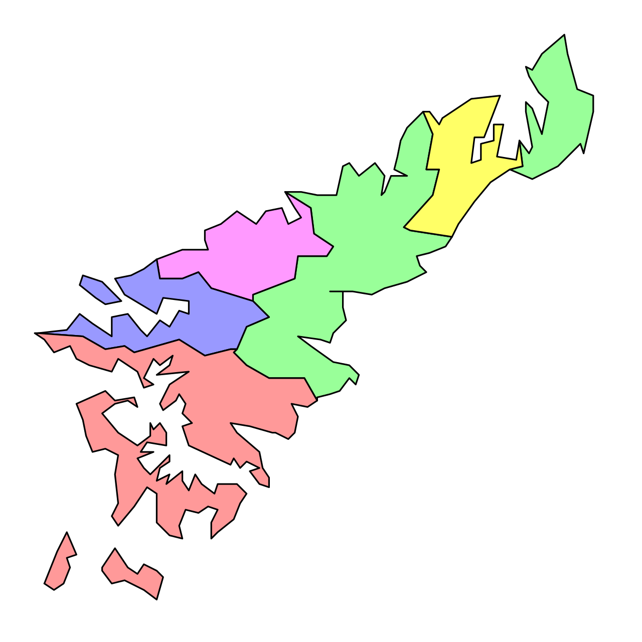
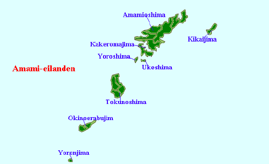
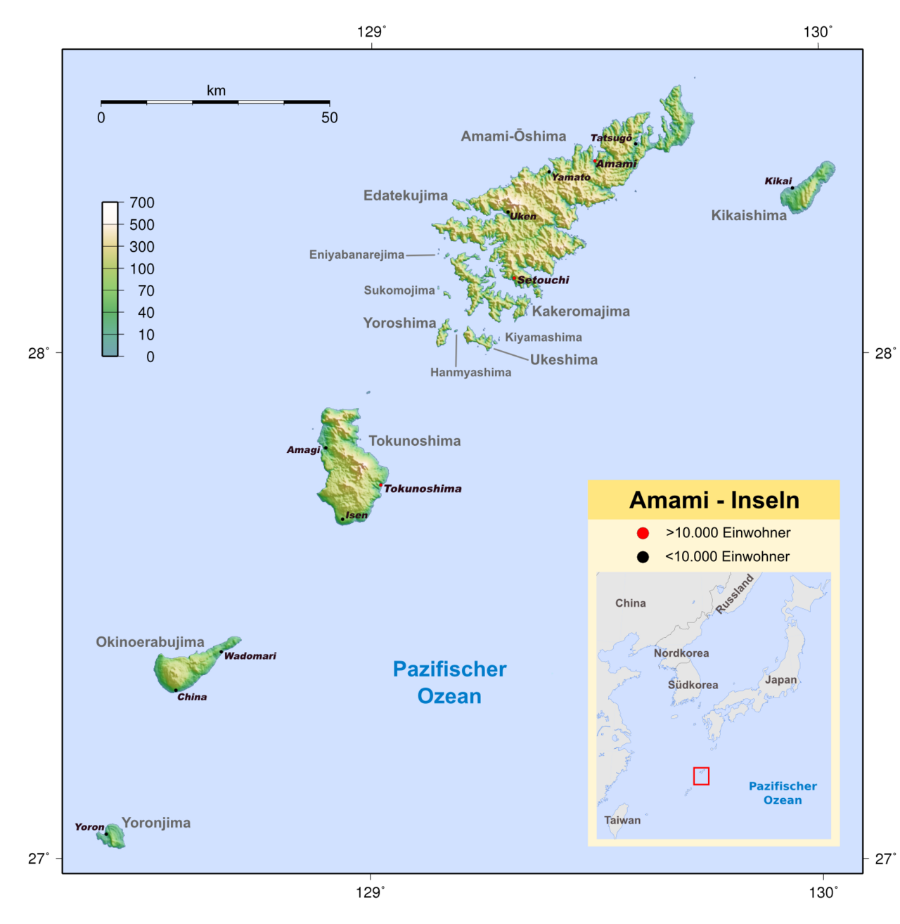
The Amami Islands form a limestone archipelago of coralline origin, stretching southwest of Kyushu as part of the broader Ryukyu chain. Spanning roughly 1,240 square kilometres, the group is divided between the city of Amami (about 308 sq km) and the Oshima district (roughly 932 sq km). The terrain peaks at Yuwandake, a 694-metre summit on Amami Ōshima, giving the islands a notably hilly profile for a coral formation. The climate is classified as humid subtropical, bringing very warm summers and gently mild winters. Rainfall is generous year-round, with pronounced peaks in May, June, and September, and the archipelago sits squarely in the path of frequent typhoons. This combination of coral geology, persistent moisture, and storm exposure has shaped both the physical landscape and the agricultural rhythms of island life for millennia.
Cultural Identity & Folk Traditions
The name "Amami" itself carries deep mythological resonance, likely sharing a root with Amamikyu, the creation goddess in Ryukyuan cosmology. This spiritual connection runs through the islands' long cultural memory. Earthenware production on the islands dates back roughly 6,000 years, initially echoing Jōmon styles from Kyushu before evolving into a distinctly local "Usuki Lower Style." In the literary record, the islands first appear in the Nihon Shoki in 657 and 682, and later in the Shoku Nihongi by 699 and 714, with the tenth imperial embassy to Tang-dynasty China routing through Amami Ōshima. Under Satsuma rule, islanders preserved their identity through sugarcane-based local liquors, awamori imported from Ryukyu, and folk songs accompanied by the sanshin. These songs developed a character distinct from Okinawan traditions and persist as a living cultural marker. Perhaps most visibly, the Satsuma-era renaming of residents left a legacy of unique one-character surnames that still distinguish Amami families today.
Sovereignty & Political History
The Amami Islands have been a contested crossroads for over a millennium. During the Heian period, local pirate groups known as the Nanbanzoku raided Satsuma and Chikuzen provinces, abducting hundreds of civilians. By the 12th century, the arrival of agriculture gave rise to a warrior-nobility class called the aji, who built gusuku castles such as Beru and Yononushi and waged territorial wars among themselves. Ryukyu's unification under Shō Hashi in 1429 brought the islands under its orbit by the 1450s, though Satsuma's 1493 invasion attempt was repelled. The decisive shift came in 1609, when Shimazu Tadatsune's Satsuma forces invaded Ryukyu to seize China-trade routes, landing first on Amami Ōshima. Ryukyu ceded the islands in 1611, and Satsuma's direct rule from 1613 gradually hardened into economic exploitation, imposing heavy sugar taxes that drove monoculture and recurring famine. The Meiji Restoration of 1871 finally folded the islands into Kagoshima Prefecture, ending centuries of layered foreign governance.
Demographics & Administrative Identity
As of October 2020, the Amami Islands were home to 104,281 residents, split between the city of Amami (41,390) and the Oshima district (62,891). Administratively, the archipelago sits within Kagoshima Prefecture, a relationship formalized after the 1871 Meiji incorporation into Ōsumi Province. The islands' official name has itself been a matter of institutional negotiation: in February 2010, Japan's Geospatial Information Authority and the Japan Coast Guard jointly settled on "Amami-guntō" as the standard designation, superseding the earlier "Amami-shotō." During World War II, more than 20,000 Japanese soldiers were stationed across the islands, yet the archipelago was never subjected to a full-scale invasion, suffering only limited aerial bombardment. The post-war American occupation period marked another chapter in the islands' long sequence of external governance, following the Satsuma, Ryukyuan, and Meiji-era arrangements that had preceded it.
Gallery
Frequently Asked Questions
What are the Amami Islands?
The Amami Islands are a Japanese archipelago made up of limestone islands of coralline origin. They form part of the Satsunan Islands within the larger Ryukyu chain and lie southwest of Kyushu.
Where are the Amami Islands located and what is their geography like?
Situated in the Satsunan Islands group of the Ryukyu archipelago, they cover roughly 1,240 square kilometres of coral-derived limestone terrain. The highest point in the group is Yuwandake, reaching 694 metres on the main island of Amami Ōshima.
What is the administrative status of the Amami Islands?
They are governed as part of Kagoshima Prefecture in Japan and have officially carried the name 'Amami-guntō' since February 15, 2010. As of the 2020 census, the archipelago was home to about 104,281 residents.
What is the climate on the Amami Islands?
The islands experience a humid subtropical climate (Köppen Cfa), meaning warm, wet summers and mild, damp winters with no true dry season. This climate supports lush vegetation across the coral limestone landscape.
What is the historical significance of the Amami Islands?
The archipelago has a layered past that includes local pirate raids, tribute ties to Ryukyuan kingdoms, and long rule under the Satsuma Domain. After World War II the islands came under American military control before being returned to Japanese sovereignty in 1953.
More in Islands Of The Pacific 1-19
Spotted an error? Know more?
This is a living reference — every entry is fact-audited, and reader corrections feed straight into our audit queue. Suggest an edit · See this site's audit record