Bonin Islands
Isolated archipelago with unique evolution and contested colonial history.

via Wikipedia: Bonin Islands · see source
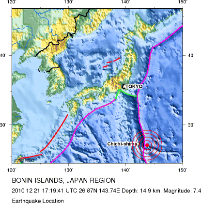
The Bonin Islands, also known as the Ogasawara Islands, are a Japanese archipelago of over 30 subtropical and tropical islands located around 1,000 kilometers SSE of Tokyo and 1,600 kilometers northwest of Guam. The group as a whole has a total area of 84 square kilometers but only two of the islands are permanently inhabited, Chichijima and Hahajima. Together, their population was 2,560 as of 2021. Administratively, Tokyo's Ogasawara Subprefecture also includes the settlements on the Volcano Islands and the Self-Defense Force post on Iwo Jima. The seat of government is Chichijima. Because of the Bonins' isolation, many of their animals and plants have undergone unique evolutionary processes. They have been referred to as the "Galápagos of the Orient" and were named a Natural World Heritage Site in 2011.
- location
- Approximately 1,000 km SSE of Tokyo and 1,600 km northwest of Guam
- area
- 84 square kilometers (32 sq mi)
- population
- 2,560 (as of 2021)
- inhabited_islands
- Chichijima and Hahajima
- world_heritage_status
- Natural World Heritage Site (2011)
- administrative_center
- Chichijima
Verified Timeline
Lore & Background
The name Bonin comes from an 1817 article in the French Journal des Savans by Jean-Pierre Abel-Rémusat in which—among various other misunderstandings of his source material—he misread a description of the islands as uninhabited (無人嶋, "desert island[s]") for their actual name, used the wrong reading of the characters (buninshima for mujintō), and then transcribed the resulting reading incorrectly into French as Bo-nin Sima, which eventually lost its original hyphen. The name Ogasawara literally means "little hat-shaped field(s)" but is used for the islands in honor of Ogasawara Sadayori, a supposed ancestor of the ronin Ogasawara Sadatō fictitiously credited with the discovery of the chain. The islands were also formerly known to Europeans as the Archbishop Islands, probably in honor of Pedro Moya de Contreras, archbishop of Mexico and viceroy of New Spain, who sent an expedition to the area in the late 16th century. The first recorded visit by Europeans to the islands happened on 2 October 1543, when the Spanish explorer Bernardo de la Torre on the San Juan sighted Haha-jima, which he charted as Forfana. The islands were uninhabited at that time. Japanese discovery of the islands occurred in Kanbun 10 (1670) and was followed by a shogunate expedition in Enpō 3 (1675). The islands were then referred to as Bunin jima (無人島, Buninjima), literally "the uninhabited islands." Shimaya Ichizaemon, the explorer at the order of the shogunate, inventoried several species of trees and birds, but after his expedition, the shogunate abandoned any plans to develop the remote islands. On 12 September 1824, American Captain James Coffin in the whaler Transit first visited the southern group of islands (Coffin Islands). In 1827, Captain F. W. Beechey of HMS Blossom reached the island chain and claimed them as a British possession. A copper plate was removed from Blossom's hull and left on a beach as a marker of the claim: "HBM Ship Blossom Capt F. W. Beechey took possession of this Group of Islands in the Name of and on the behalf of His Britannic Majesty George the IV on the 14th June 1827." He also named the island of Chichijima "Peel" after then British Home Secretary Sir Robert Peel. Beechey was also surprised to find two men living on the islands. They remained on the islands after the William left the year before in 1826. The men were Wittrein and Petersen. In 1830, with the help of the British Consul to the Sandwich Islands (Hawaii), Richard Charlton, Richard Millichamp, and Matteo Mazzaro sailed to the islands. The first permanent colony was made up of Nathaniel Savory of Bradford, Massachusetts, America, Richard Millichamp of Devon, England; Matteo Mazzaro of Ragusa/Dubrovnik, Austrian Empire (now in Croatia); Alden B. Chapin and Nathaniel Savory of Boston; Carl Johnsen of Copenhagen; as well as seven unnamed men and 13 women from the Kingdom of Hawaii. They found the climate suitable for farming and the raising of livestock. Rum was made from cane sugar, and bordellos were opened, sometimes staffed by women kidnapped from other island chains. Whalers and other ships that could not find another friendly port in Japan often visited the Bonins for provision and recreation. Commodore Matthew C. Perry of the United States Navy visited the islands in 1853 and bought a property at Port Lloyd from Savory for $50. The US "Colony of Peel Island" (Chichijima) was created, and Savory was appointed governor. In 1853 there were Peel Island 31 inhabitants, made up as follows; four English, four American, one Portuguese, the rest being natives from either the Sandwich, the Ladrones, the Caroline or Kingsmill islands, together with children born on the Bonins. In January 1862 (Bunkyū 1), the Tokugawa shogunate of Japan claimed the islands in a short-lived colonial enterprise. The shogunal steamboat Kanrin Maru was dispatched to the islands with a crew of cartographers, physicians, and prominent bureaucrats. The islands were officially renamed Ogasawara, referring to the legendary Japanese discoverer from the late 16th century. This tentative colonization, however, did not last for long. In the summer of 1863, under foreign pressure, the shogunate ordered the evacuation of the islands. In 1875, the Japanese Meiji government reclaimed the islands. The Japanese names of each island were resolved, and 38 settlers from Hachijojima were sent the following year. In 1876, the islands were put under the direct control of the Home Ministry. Further foreign settlements were banned, and the government assisted settlers who wished to relocate from mainland Japan. The islands' forests were also reduced to use the land for sugar cane production. Colonists largely segregated.
Reader's Guide
The Bonin Islands are significant for their unique biodiversity, often compared to the Galápagos, and their complex colonial history involving Spanish, British, American, and Japanese claims. The islands were uninhabited when first reached in the early modern period, though prehistoric tools and carved stones indicate some Micronesian habitation. The 1830 settlement by a multi-ethnic group from Hawaii, Europe, and America established a community that persisted through Japanese colonization and US occupation. Ethnically, the islands are now majority Japanese but remain unusually diverse, reflected in the local Creole language Bonin English. Improved transportation has made agriculture more profitable and encouraged tourism, but development for an airport remains contentious. The islands' isolation has preserved unique evolutionary processes, earning them World Heritage status in 2011. Their history illustrates the intersection of imperial ambitions, whaling routes, and ecological significance in the Pacific.
Did You Know?
- The name 'Bonin' comes from a 1817 French article that misread a Japanese description of the islands as 'uninhabited' (無人嶋) as their actual name, used the wrong reading (buninshima for mujintō), and then transcribed it incorrectly into French as 'Bo-nin Sima'.
- The first permanent colony in 1830 included Nathaniel Savory from Massachusetts, Richard Millichamp from England, Matteo Mazzaro from Ragusa/Dubrovnik, and 13 women from the Kingdom of Hawaii.
- Commodore Matthew C. Perry bought a property at Port Lloyd from Nathaniel Savory for $50 in 1853 and created the US 'Colony of Peel Island', appointing Savory as governor.
- The Tokugawa shogunate claimed the islands in January 1862, renaming them Ogasawara, but evacuated them in summer 1863 under foreign pressure.
- A woman from the Caroline Islands named Hypa, who arrived in 1846, died in 1897 at the age of about 112 after being baptized on her deathbed.
A Name Born of Misunderstanding
The very name "Bonin" is a product of scholarly error. In 1817, French sinologist Jean-Pierre Abel-Rémusat, writing in the Journal des Savans, misread a Japanese source describing the islands. Where the text actually referred to them by their proper name, he interpreted the characters as meaning "desert island," applied the wrong phonetic reading, and transcribed the result into French as "Bo-nin Sima." The hyphen eventually disappeared, leaving the now-familiar "Bonin." Meanwhile, the Japanese name Ogasawara literally translates to "little hat-shaped fields" but was adopted in honor of Ogasawara Sadayori, a supposed ancestor of a ronin fictitiously credited with discovering the chain. European sources of the 18th and 19th centuries called them the Archbishop Islands, likely honoring Pedro Moya de Contreras, the archbishop of Mexico who dispatched an expedition into the northern Pacific in 1587 searching for legendary gold and silver islands. The archipelago thus carries three distinct naming traditions, each reflecting a different culture's encounter with these remote atolls.
Layers of Discovery and Dispossession
The Bonin Islands experienced a long sequence of arrivals and departures that shaped their modern identity. Spanish explorer Bernardo de la Torre sighted Hahajima in 1543, charting it as Forfana, while the islands stood entirely uninhabited. Japan's shogunate mounted an expedition in 1675, during which explorer Shimaya Ichizaemon catalogued local flora and fauna, yet the government abandoned any plans for development. The islands languished in obscurity until a passing British captain formally claimed them in 1827. Hawaiian colonists followed in 1830, building a multicultural community that persisted until World War II, when the Japanese government forcibly relocated most islanders to Honshu. After Japan's defeat, the US Navy occupied the territory, bulldozing existing Japanese homes and restricting resettlement. Full sovereignty was not restored to Japan until 1968. Each episode of arrival and departure left enduring traces in the islands' demographics, built environment, and collective memory.
The Galápagos of the Orient
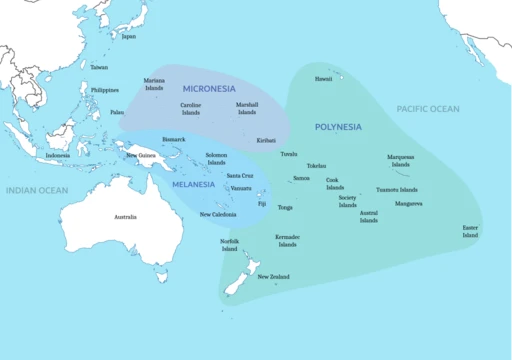
Geographic isolation has made the Bonin Islands a natural laboratory. Situated roughly 1,000 kilometers southeast of Tokyo and 1,600 kilometers northwest of Guam, the archipelago's more than thirty subtropical and tropical islands have fostered evolutionary pathways unlike those found on the Japanese mainland. Animals and plants here have developed in ways that earned the group the nickname "Galápagos of the Orient," and in 2011 UNESCO recognized this biological distinctiveness by designating the islands a Natural World Heritage Site. The total land area is a modest 84 square kilometers, yet the evolutionary story is extraordinary. Archaeological findings at the close of the twentieth century—prehistoric tools and carved stones uncovered on North Iwo Jima and Chichijima—revealed that an unknown Micronesian people once inhabited the islands, adding a human dimension to the story of life in this remote corner of the Pacific.
A Small, Diverse Community in Transition
Only two of the Bonin Islands' thirty-plus members, Chichijima and Hahajima, support permanent residents, and together they were home to 2,560 people as of 2021. The seat of local government sits on Chichijima, while Tokyo's Ogasawara Subprefecture also encompasses settlements on the Volcano Islands and a Self-Defense Force installation on Iwo Jima. Despite being ethnically majority Japanese today, the community retains an unusual diversity rooted in the Hawaiian, European, and American colonial heritage of the nineteenth century. This mixed ancestry is preserved in a local Creole known as Bonin English, a living linguistic artifact of the islands' layered past. Improved transportation links have made agriculture more lucrative and drawn growing numbers of tourists, yet the prospect of building an airport remains a deeply contentious local issue, pitting the economic promise of greater accessibility against the environmental and cultural costs of large-scale development.
Gallery
Frequently Asked Questions
What are the Bonin Islands?
The Bonin Islands, also called the Ogasawara Islands, are a Japanese archipelago of more than 30 subtropical and tropical islands. The group spans roughly 84 square kilometers and is administered as Tokyo's Ogasawara Subprefecture, with Chichijima serving as the seat of government.
Where exactly are the Bonin Islands located?
They sit in the western Pacific, roughly 1,000 kilometers south-southeast of Tokyo and about 1,600 kilometers northwest of Guam. This remote positioning has shaped both their ecology and their contested colonial history.
Which Bonin Islands are actually inhabited?
Only two islands—Chichijima and Hahajima—have permanent residents, together home to about 2,560 people as of 2021. The remaining islands in the archipelago are largely uninhabited, though the subprefecture's jurisdiction extends to the Volcano Islands and the Self-Defense Force post on Iwo Jima.
Why did the Bonin Islands receive UNESCO World Heritage status?
In 2011 the group was inscribed as a Natural World Heritage Site because extreme isolation over millions of years produced a remarkable concentration of endemic species found nowhere else on Earth. The unique evolutionary trajectories of its plants and animals are the core reason for the designation.
What makes the Bonin Islands ecologically significant?
Their long separation from mainland ecosystems allowed animals and plants to diverge into forms unique to the archipelago, creating one of the Pacific's richest pockets of endemism. This isolation-driven evolution is the primary factor behind both their scientific importance and their World Heritage listing.
More in Islands Of The Pacific 1-19
Spotted an error? Know more?
This is a living reference — every entry is fact-audited, and reader corrections feed straight into our audit queue. Suggest an edit · See this site's audit record